|
Map Description
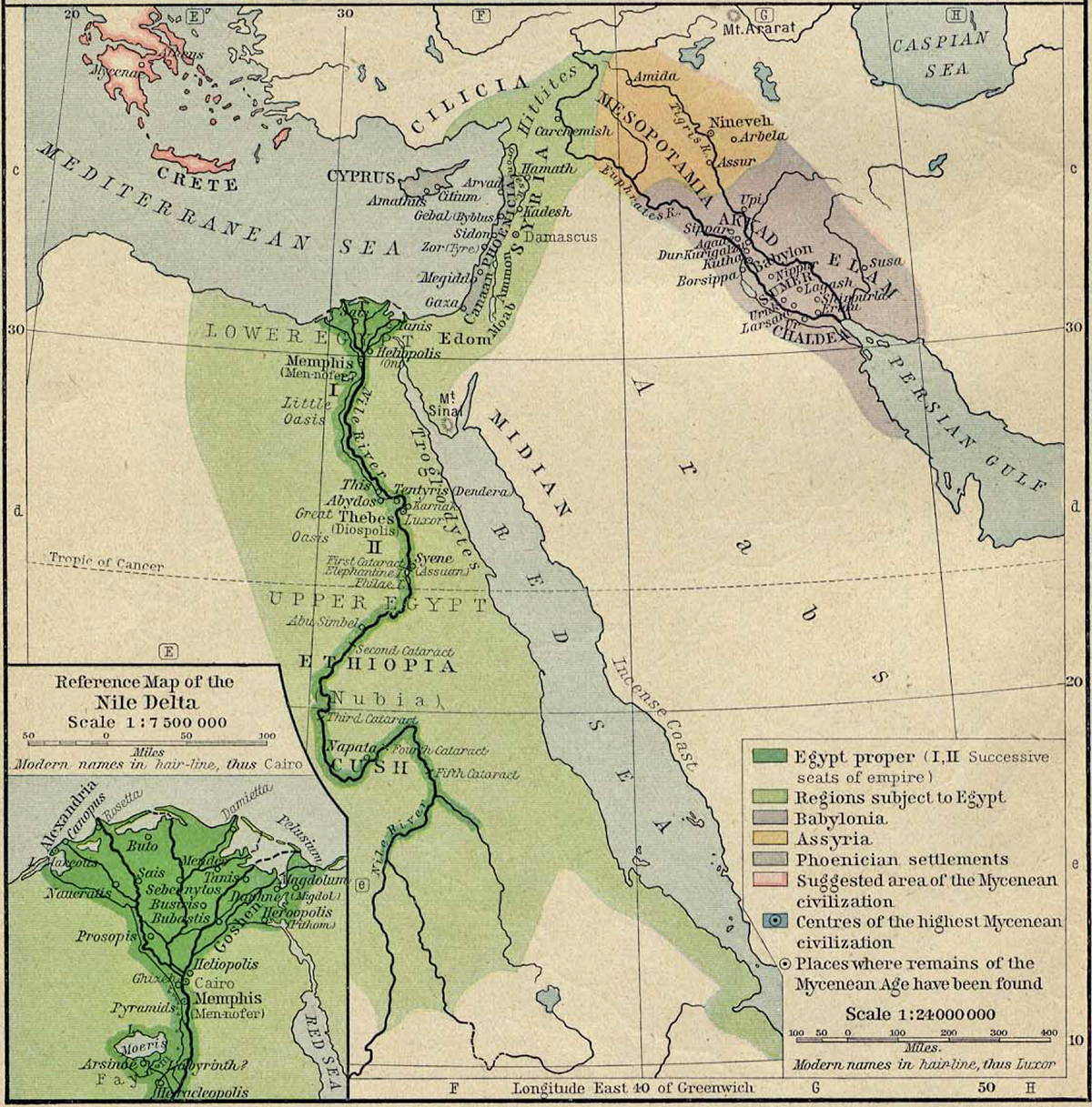
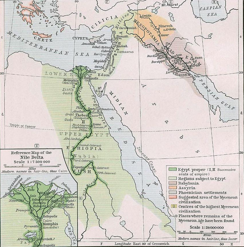
Two versions of a historical Map of
Ancient Egypt, Ancient Syria,
and Ancient Mesopotamia about 1450 B.C.
Illustrating
Egypt
proper (I, II Successive seats of empire)
Regions subject to Egypt
Babylonia
Assyria
Phoenician settlements
Suggested area of the Mycenean (Mycenaean) civilization
Centers of the highest Mycenean civilization (See
 Map of Greece and the Orient 1450 BC)
Places where remains of the Mycenean age have been found
(See
Map of Greece and the Orient 1450 BC)
Modern names in hairline
Inset: Reference Map of the Nile Delta
(See also
Map of the Nile Delta 1450 BC)
Credits
University of Texas at Austin.
Historical Atlas by William Shepherd (1911 and 1923, respectively).
Related Links
About the Phoenicians
About the Ancient Egyptians
About the Ancient Sumerians
About the Gilgamesh
About the Rulers of Sumer
About the Ancient Akkadians
Related Maps
Map of Greece and the Orient 1450 BC
Map of the Nile Delta 1450 BC
Map of Greece 1450 BC
Map of Egypt and Syria in 1798
Map of Egypt 1910
More History
 |