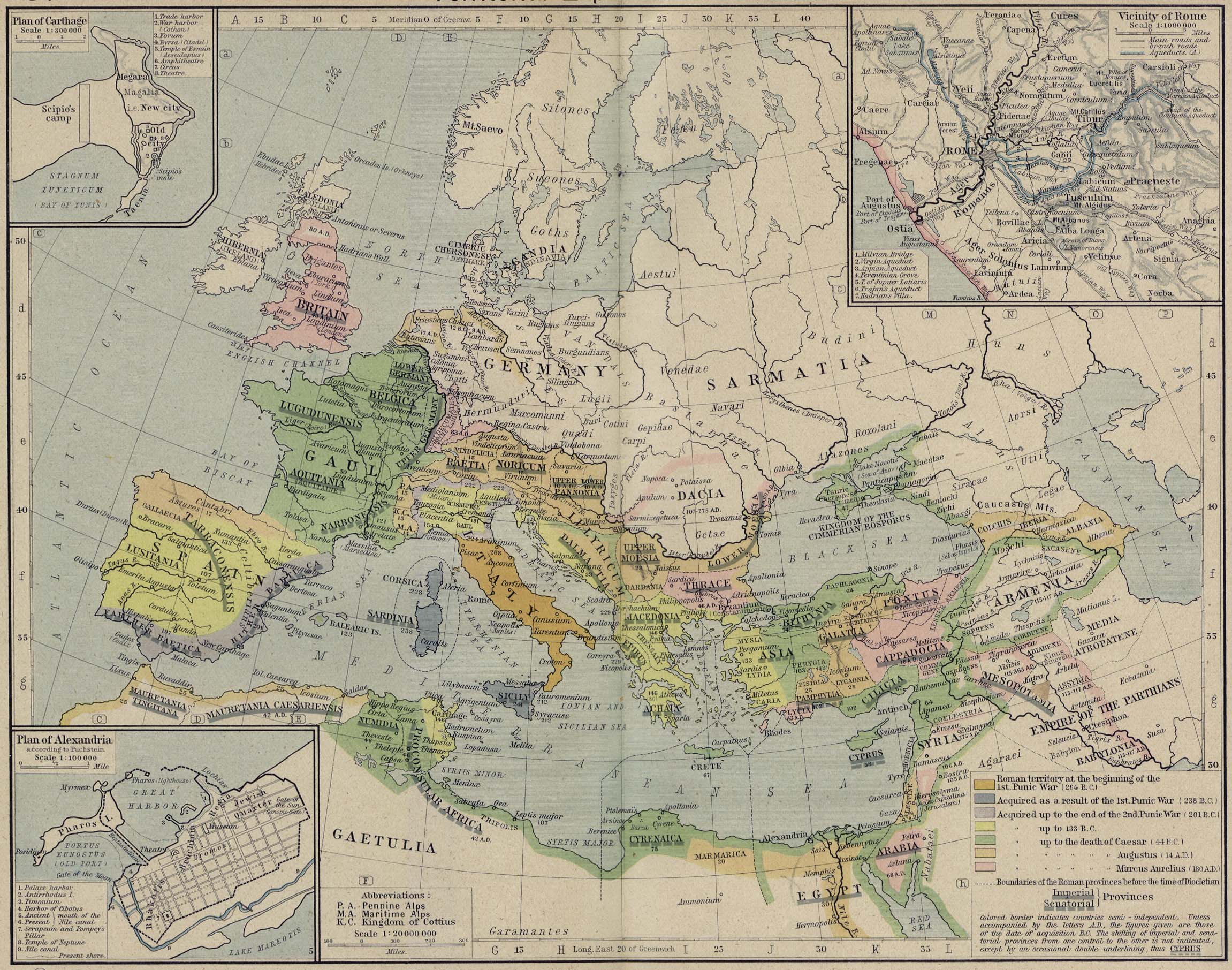
Territorial Expansion of Rome.
Insets: Plan of Carthage. Vicinity of
Rome. Plan of Alexandria.
- Roman territory at the beginning of
the
 First
Punic War (264 BC)
First
Punic War (264 BC)
- Acquired as a result of the
First
Punic War (238 BC)
- Acquired up to the end of the
Second
Punic War (201 BC)
- Acquired up to 133 BC
- Acquired up to the death of
Caesar (44 BC)
- Acquired up to the death of
Augustus (14 AD)
- Acquired up to the death of
Marcus Aurelius
(180 AD)
- Boundaries of the Roman provinces before the time of
Diocletian
- Roman Provinces
- Colored border indicates countries semi-independent. Unless
accompanied by the letters A.D., the figures
given are those of the date of acquisition B.C. The shifting of
imperial and senatorial provinces from one
control to the other is not indicated, except by an occasional
double underlining.