|
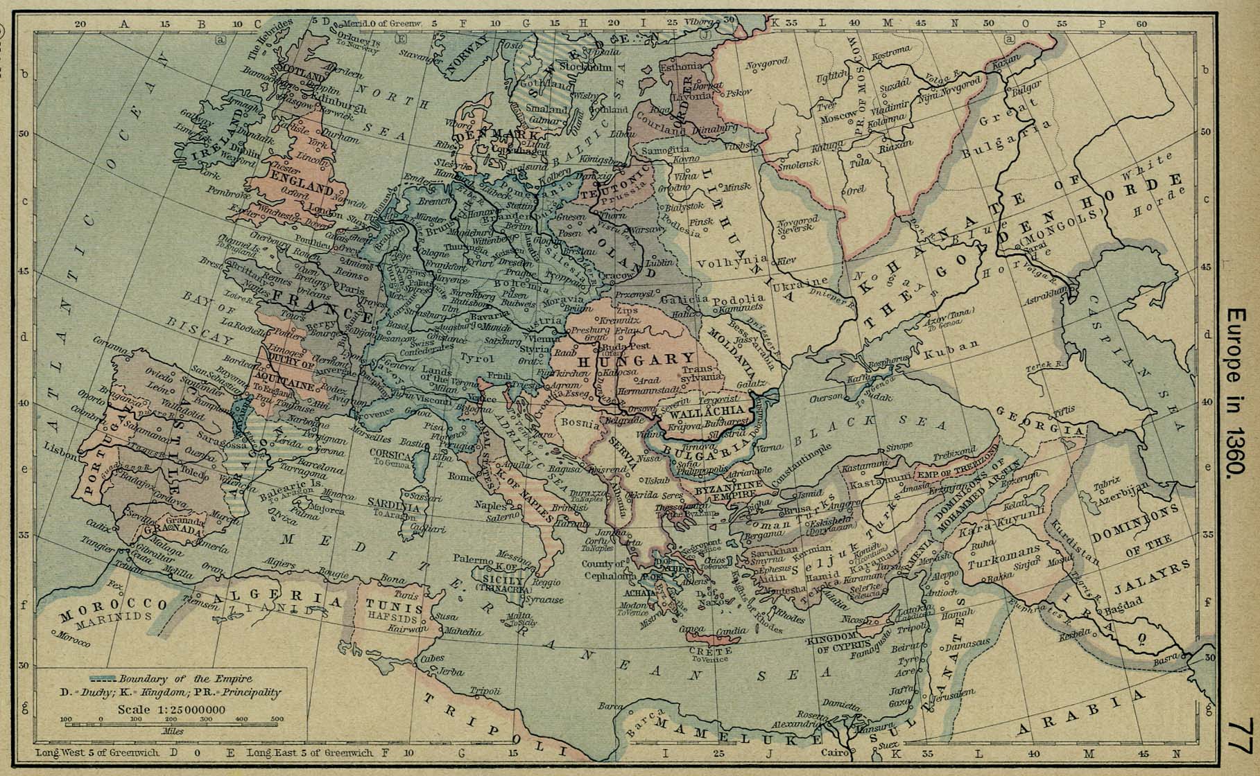
Map Description
Historical map of Europe in
1360.
Illustrating
-
Boundary of the Empire
D - Duchy
K - Kingdom
PR - Principality
Credits
University of Texas at Austin.
Historical Atlas by William Shepherd (1923-26).
Related Maps
 Map of Europe about 1190
Map of Europe about
1490
Map of Europe about 1190
Map of Europe about
1490
More History
 |
