|
Map Description
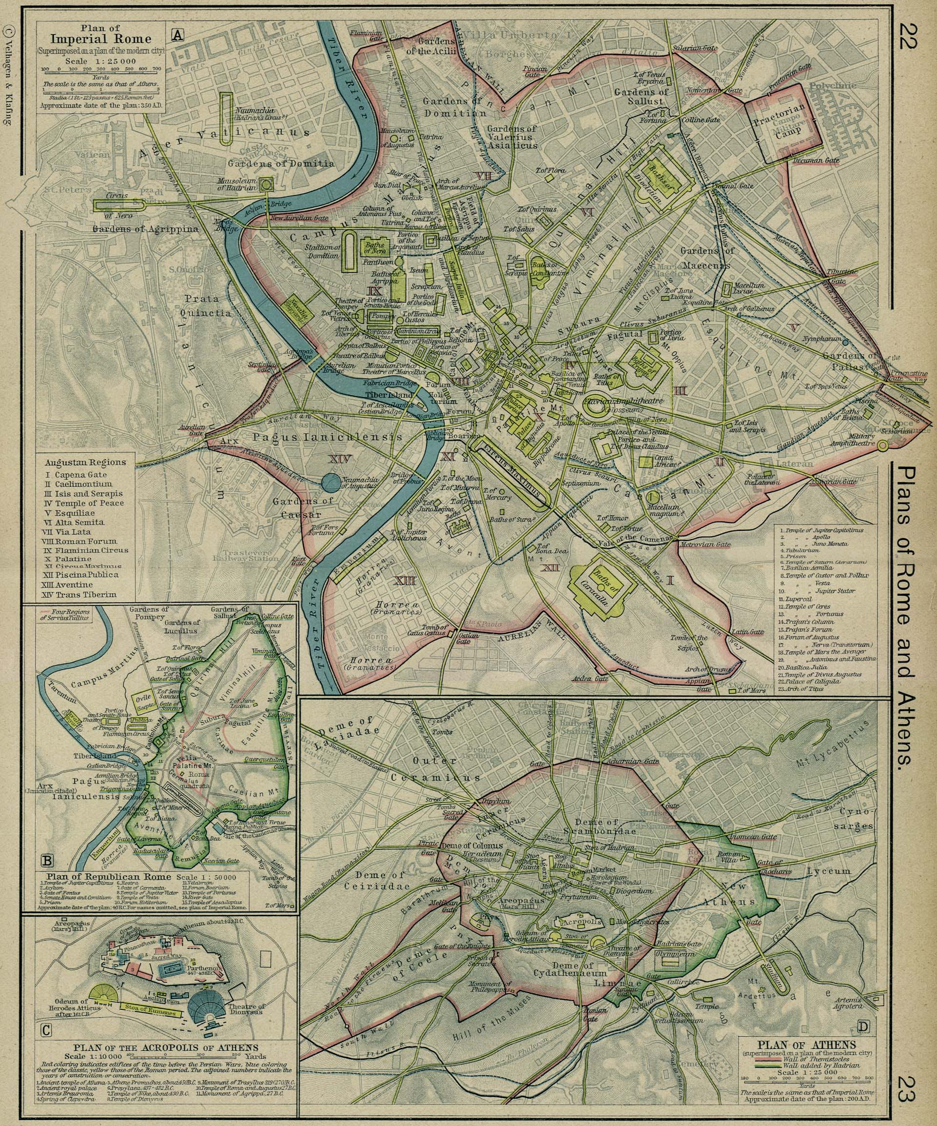
Historical Map of Rome in 350
AD and Athens in 200 AD.
Plan of Imperial Rome 350 AD
Plan of Republican Rome 40 BC
Plan of the Acropolis of Athens
Plan of Athens 200 AD
Plan of Imperial Rome superimposed on
a plan of the modern city. Approximate date of the plan: 350 A.D.
Augustan Regions
I Capena Gate
II Caelimontium
III Isis and Serapis
IV Temple of Peace
V Esquiliae
VI Alta Semita
VII Via Lata
VIII Roman Forum
IX Flaminian Circus
X Palatine
XI Circus Maximus
XII Piscina Publica
XIII Aventine
XIV Trans Tiberim
Credits
University of Texas at Austin.
Historical Atlas by William Shepherd (1923-26).
Related Links
 About Augustus
About Servius Tullius
About Marcus Vipsanius Agrippa
About Herodes Atticus
About Augustus
About Servius Tullius
About Marcus Vipsanius Agrippa
About Herodes Atticus
About Hadrian
About Themistocles
About the Persian Wars
About Ancient Rome
Roman Britain
Related Maps
Map of the Forum Romanum
Map of the Vicinity of Rome
Map of Republican Rome
Map of the Roman Bishoprics 12th Century
Map of Rome in the Middle Ages
Map of the Acropolis
Map of Athens
More History
 |
