|
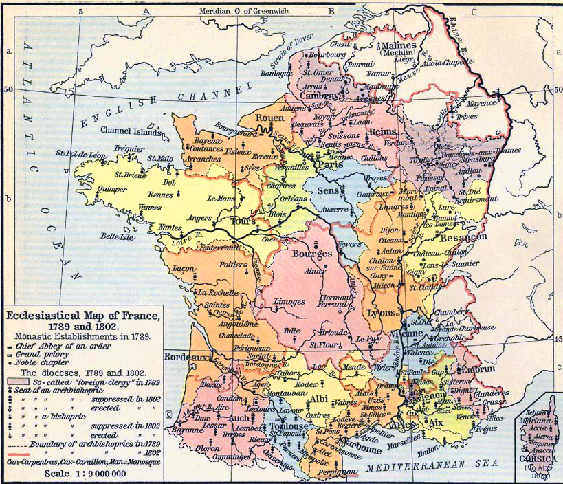
Map Description
Ecclesiastical Map of France,
1789 and 1802
Illustrating
-
Monastic Establishments in 1789
- Chief Abbey of an order
- Grand priory
- Noble chapter
- The dioceses, 1789 and 1802
- So-called "foreign clergy" in 1789
- Seat of an archbishopric
- Seat of an archbishopric suppressed in 1802
- Seat of an archbishopric erected in 1802
- Seat of a bishopric
- Seat of a bishopric suppressed in 1802
- Seat of a bishopric erected in 1802
- Boundary of archbishoprics in 1789
- Boundary of archbishoprics in 1802
Credits
University of Texas at Austin.
Historical Atlas by William Shepherd (1911).
Related Links
 About the French Revolution
ary Wars
About the French Revolution
About the French Revolutionary Wars
Related Maps
Salt Tax / Gabelle France 1781
Necker's Trade Map France 1781
Ecclesiastical Map of Western Europe
Ecclesiastical Map of
the British Isles
More History
 |
