|
Map Description
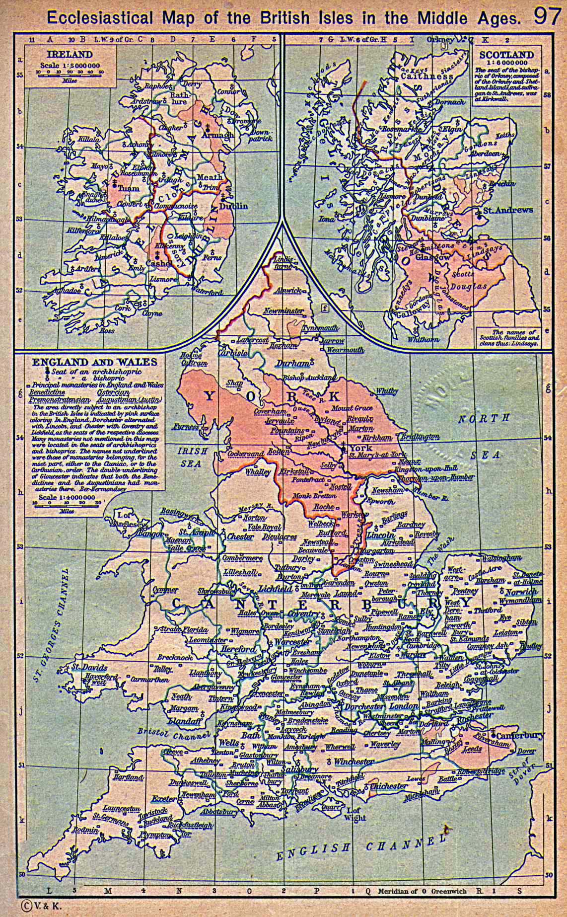
Ecclesiastical Map of the
British Isles in the Middle Ages.
Illustrating
Ireland
Scotland
The seat of the bishopric of Orkney, composed of the Orkney and
Shetland Islands and
suffragan to St. Andrews, was at Kirkwall.
England and Wales
- Seat of an archbishopric
- Seat of a bishopric
- Principal monasteries in England and Wales
- Benedictine (See also
 Saint Benedict)
- Cistercian
- Premonstratensian
- Augustinian (Austin) (See also
Saint Augustine)
The area directly subject to an archbishop in the British Isles
is indicated by pink surface
coloring. In England, Dorchester alternated with Lincoln, and
Chester with Coventry and
Lichfield, as the seats of the respective dioceses. Many
monasteries not mentioned in
this map were located in the seats of archbishoprics and
bishoprics. The names not
underlined were those of monasteries belonging for the most part
either to the Cluniac,
or to the Carthusian order. The double underlining of Gloucester
indicates that both, the
Benedictine and the Augustinians had monasteries there.
Credits
University of Texas at Austin.
Historical Atlas by William Shepherd (1923-26).
Related Maps
Map of the British Isles 1300
Ecclesiastical Map of Western Europe in the
Middle Ages
Map
of the Bishopric of Winchester during the Middle Ages
More History
 |
