|
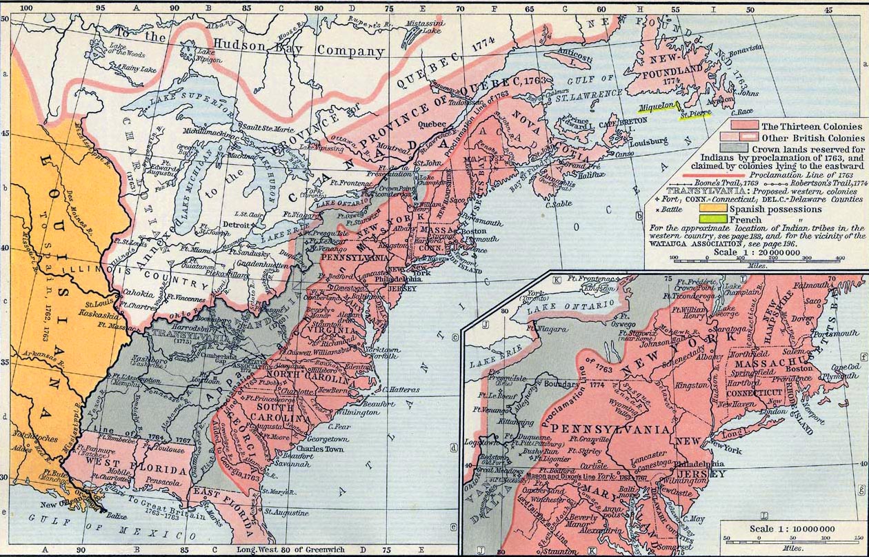
Map Description
Historical Map of the British
Colonies in North America, 1763-1775.
Illustrating
- The Thirteen Colonies
-
Other British Colonies
-
Crown lands reserved for Indians by proclamation of 1763, and
claimed by colonies
lying to the eastward
- Boone's Trail 1769
- Robertson's Trail 1774
-
Proposed western colonies
-
Fort
-
Battle
-
Counties
-
Spanish possessions
-
French possessions
- To the
 Hudson's
Bay Company
Hudson's
Bay Company
-
Annexed to the Province of Quebec 1774
-
Province of Quebec 1763
For the approximate location of Indian tribes in the western country
see
Map of the United States: Native Americans
until 1911
and for the vicinity of the Watauga Association, see
Map of the United States, 1783-1803
Inset: Middle Colonies.
- Proclamation Line of 1763
-
New Hampshire
-
Massachusetts Bay
-
Connecticut
-
Rhode Island
-
New York
-
New Jersey
-
Pennsylvania
-
Maryland
Please note: The northern
border line of West Florida, here with the annotation "Line of
1764, 1767", was established on June 6, 1764. See more
here.
Credits
University of Texas at Austin.
Historical Atlas by William Shepherd (1911).
Related Links
About the American
Revolution
Related Maps
Map of the Middle Colonies 1607-1760
Map of the Southern Colonies 1607-1760
More History
 |
