|
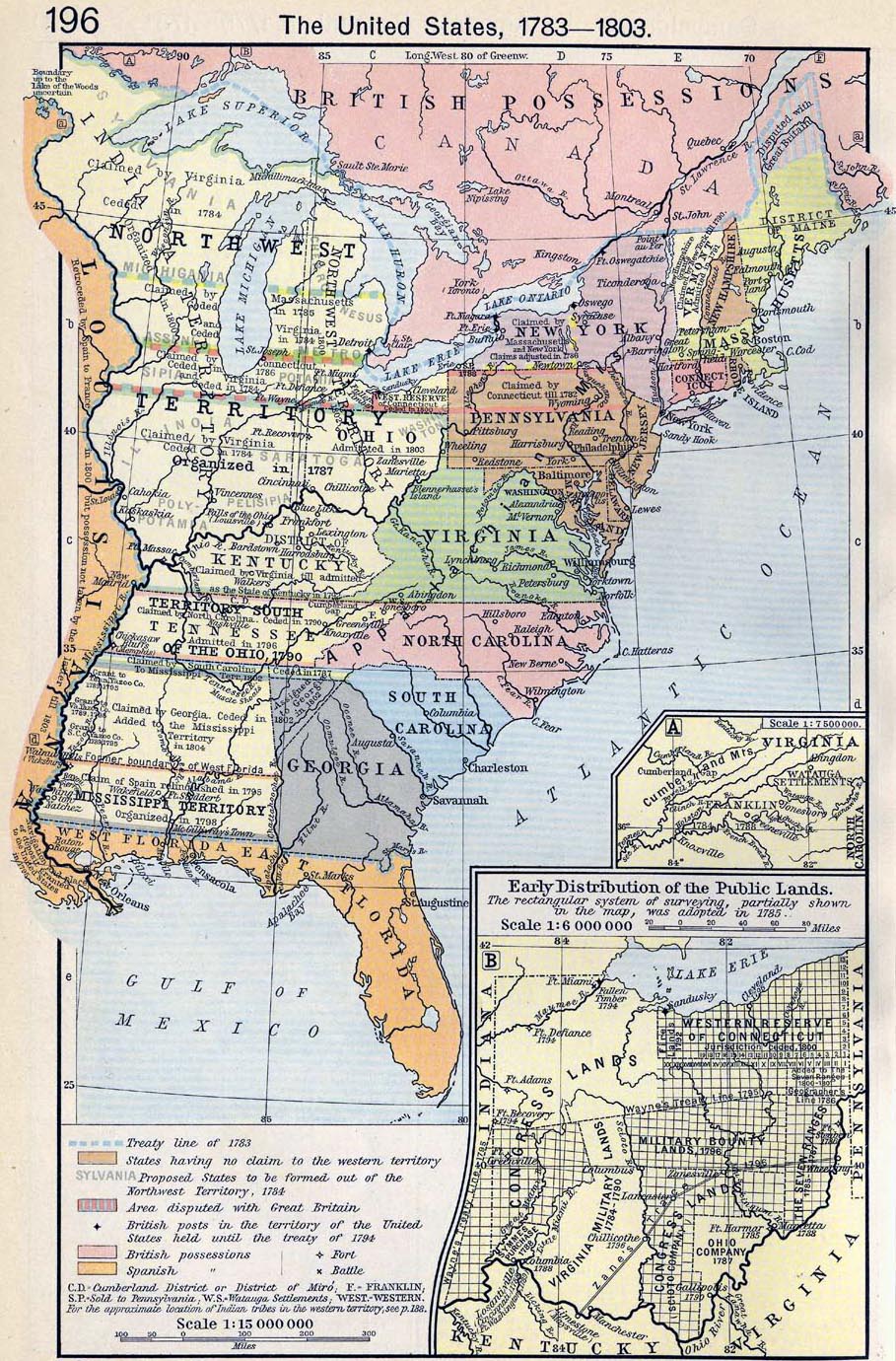
Map Description
Historical Map of the United
States 1783-1803
Illustrating
-
Treaty line of 1783
- States having no claim to the western territory
- Proposed States to be formed out of the Northwest Territory,
1784
- Area disputed with Great Britain
- British posts in the territory of the United States held until
the treaty of 1794
- British and Spanish possessions
- Fort / Battle
C.D. = Cumberland District or District of Miro
F. = Franklin
S.P. = Sold to Pennsylvania
W.S. = Watauga Settlements
For the approximate location of Indian tribes in the western
territory
see
 Map of the United States: Native Americans
until 1911
Map of the United States: Native Americans
until 1911
Inset A: The State
of Franklin, 1784-1788
-
Virginia, Cumberland Mountains, Franklin, Watauga Settlements,
Knoxville, Greeneville
Inset B: Early
distribution of the Public Lands (Ohio)
The
rectangular system of surveying, partially shown in the map, was
adopted in 1785.
- Western Reserve of Connecticut, Military Bounty Lands,
Congress Lands, Virginia Military
Lands, Symmes Purchase, The Seven Ranges, Ohio Company
Please note: This map is not
entirely correct in illustrating the border between East and West
Florida.
The correct border between the Floridas was the Apalachicola River.
See more under
West Florida.
Credits
University of Texas at Austin.
Historical Atlas by William Shepherd (1911).
Related Links
About the American
Revolution
Related Maps
Map of European Exploration and Settlement in
the United States, 1513-1776
More History
 |
