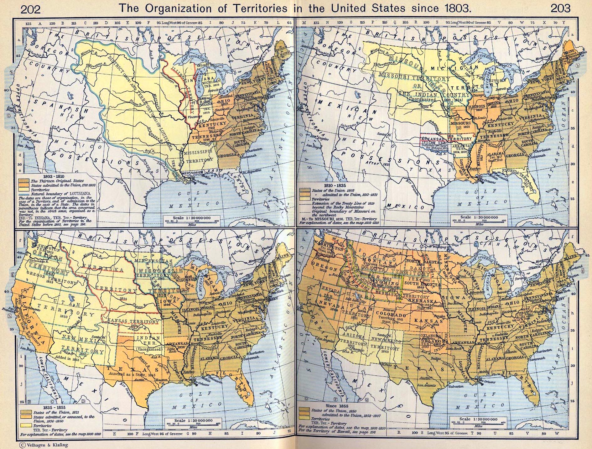
I.1803-1810
Illustrating:
- The Thirteen Original States
- States admitted to the Union, 1791-1803
- Territories
- Natural boundary of Louisiana
The dates are those of organization, in the case of a Territory,
and of admission to the
Union, in the case of a State. The dates in parentheses indicate
that the area concerned
was not, in the strict sense, organized as a Territory. For the
organization of Territories
in the United States before 1803, see
 Map
of the United States, 1783-1803
Map
of the United States, 1783-1803
Please note: There is a
mistake with West Florida and East Florida.
West
Florida is shown to reach from the Mississippi River to the
Perdido River. Actually,
it reached from the Mississippi River all the way to the
Apalachicola River. Part of it was
occupied by the U.S., part of it claimed by the U.S., and part
of it belonged to Spain
without any dispute. See more under
West Florida.
II.1810-1835
Illustrating:
- States of the Union 1803
- States admitted to the Union, 1812-1821
- Territories
- Extension of the Treaty Line of 1819 beyond the Rocky
Mountains
- Original boundary of Missouri on the northwest
For explanation of dates, see the map 1803-1810.
III.1835-1855
Illustrating:
- States of the Union, 1821
- States admitted, or annexed, to the Union, 1836-1850
- Territories
For explanation of dates, see the map 1803-1810.
IV. Since 1855
Illustrating:
- States of the Union, 1850
- States admitted to the Union, 1858-1907
- Territories
For explanation of dates, see the map 1803-1810.
For the Territory of Hawaii, see
Map of the Territorial Expansion of the
United States since 1803