|
Map Description
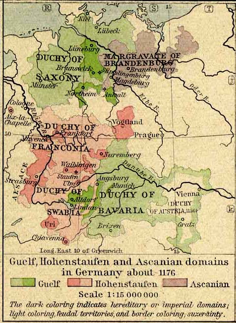
Historical Map Germany about
1176.
Illustrating
The Guelf,
Hohenstaufen and Ascanian Domains
The dark coloring indicates hereditary
or imperial domains; light coloring, feudal territories,
and border coloring, suzerainty.
Credits
University of Texas at Austin.
Historical Atlas by William Shepherd (1923-26)
Related Links
 About the Crusades
About the Hohenstaufen Dynasty
About the Ascanian Dynasty
About the Crusades
About the Hohenstaufen Dynasty
About the Ascanian Dynasty
About the Welf Dynasty
About the Holy Roman Empire
Related Maps
Map of Europe and the Mediterranean Lands 1190
More History
 |
