|
Map Description
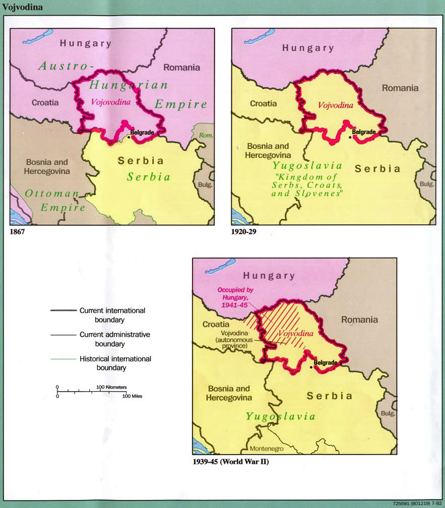
History Map of Vojvodina
1867-1992
Illustrating
Map A - Vojvodina 1867
Map B - Vojvodina 1920-1929
Map C - Vojvodina 1939-1945 (World War II)
Current international boundary
Current administrative boundary
Historical international boundary
Credits
From Former Yugoslavia: A
Map Folio U.S. Central Intelligence Agency, 1992.
Perry-Castañeda Library Map Collection, The University of Texas at
Austin.
Related Maps
 Map of the Balkan Peninsula 1878-1910
Map of the distribution of races in the Balkan
Peninsula and Asia Minor 1911
Map of the Balkan Peninsula 1878-1910
Map of the distribution of races in the Balkan
Peninsula and Asia Minor 1911
Map of WWII: The Balkans 1941
Map of WWI: Invasions of Serbia - 1914
Map of WWI: Serbia and the Salonika Expedition
- 1915
More History
 |