|
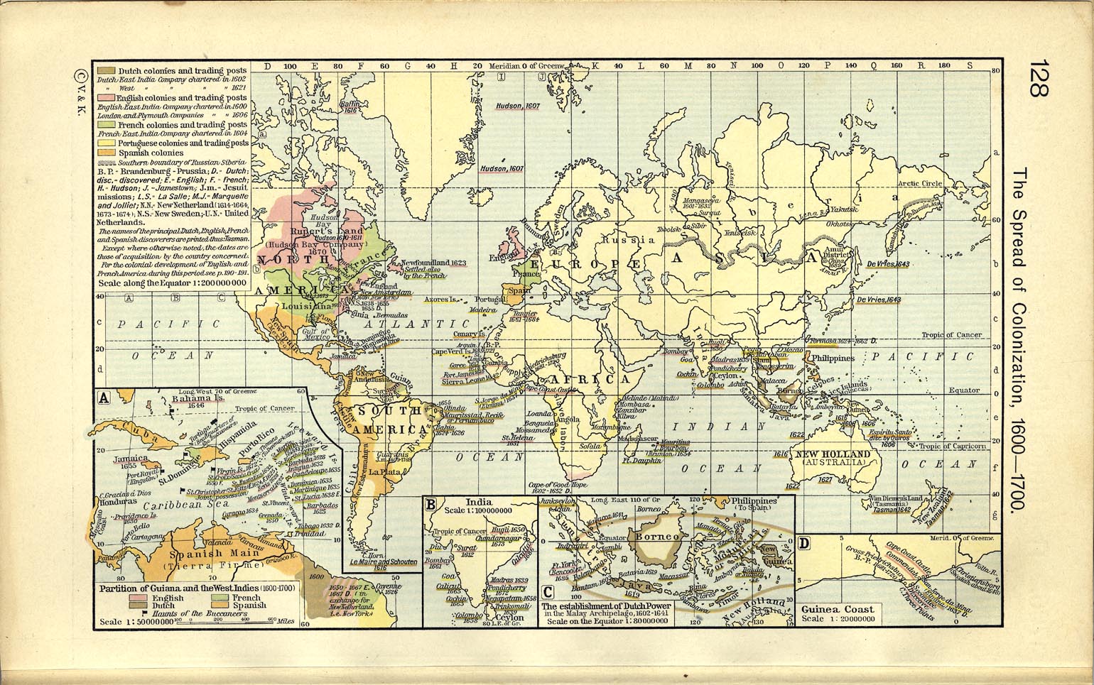
Map Description
Historical World Map 17th
Century. The Spread of Colonization, 1600-1700.
Inset
maps:
- Partition of Guiana and the West Indies 1600-1700
- India
- The Establishment of Dutch Power in the Malay Archipelago,
1602-1641
- Guinea Coast
Credits
University of Texas at Austin.
From Historical Atlas by William R. Shepherd, 1911.
Related Links
 Treaty of Fontainebleau 1762
Related Maps
Map of the Spanish and Portuguese Discoveries
World Map 16th Century
More History
 |
