|
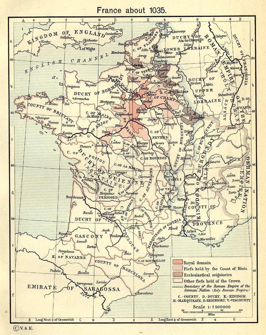
Map Description
Historical Map of France around
the year 1035
Illustrating
Royal
domain
Fiefs held by the Count of Blois
Ecclesiastical seigniories
Other fiefs held of the Crown
Boundary of the Roman Empire of the German Nation (Holy Roman
Empire)
Credits
University of Texas at Austin.
From The Historical Atlas by William R. Shepherd, 1911.
Related Links
 About the Holy Roman Empire
About the Capetian Dynasty
About Blois
About the Holy Roman Empire
About the Capetian Dynasty
About Blois
Related Maps
Map of Champagne 12th
Century
More History
 |
