|
Map Description
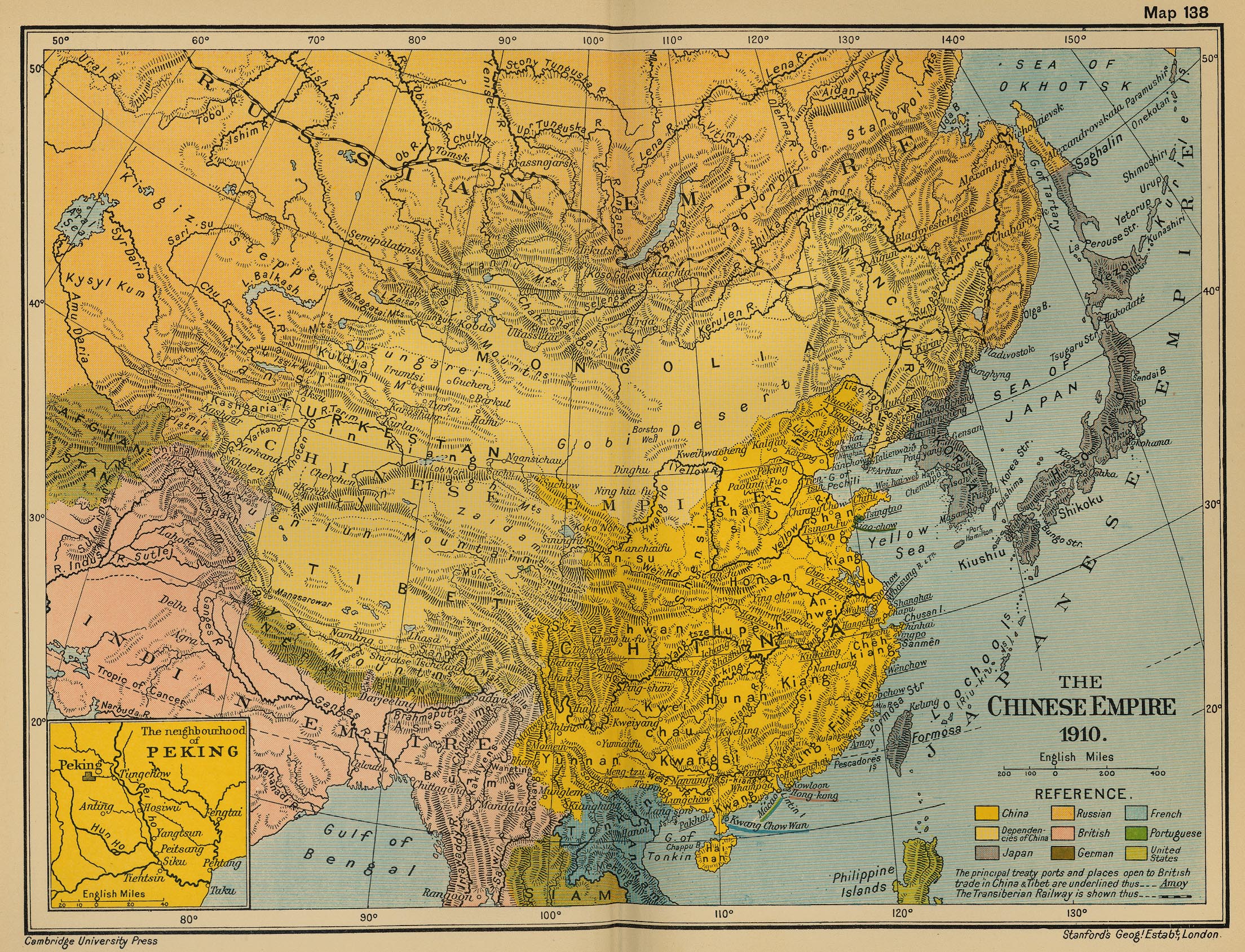
Historical Map of the Chinese
Empire 1910.
Illustrating
-
China
- Dependencies of China
- Japan
- Russian
- British
- German
- French
- Portuguese
- United States
The principal treaty ports and places open to British trade in
China & Tibet are underlined.
- The Transiberian Railway (Trans Siberian Railway)
Inset: The Neighborhood of Peking.
Credits
University of Texas at Austin.
From the Cambridge Modern History Atlas, 1912.
Related Links
 About Sun Yat-sen
About Chiang Kai-shek
About Mao Zedong
Governments of China
About Sun Yat-sen
About Chiang Kai-shek
About Mao Zedong
Governments of China
Related Maps
Map of the growth of European and Japanese
dominions in Asia since 1801
More History
 |
