|
Map Description
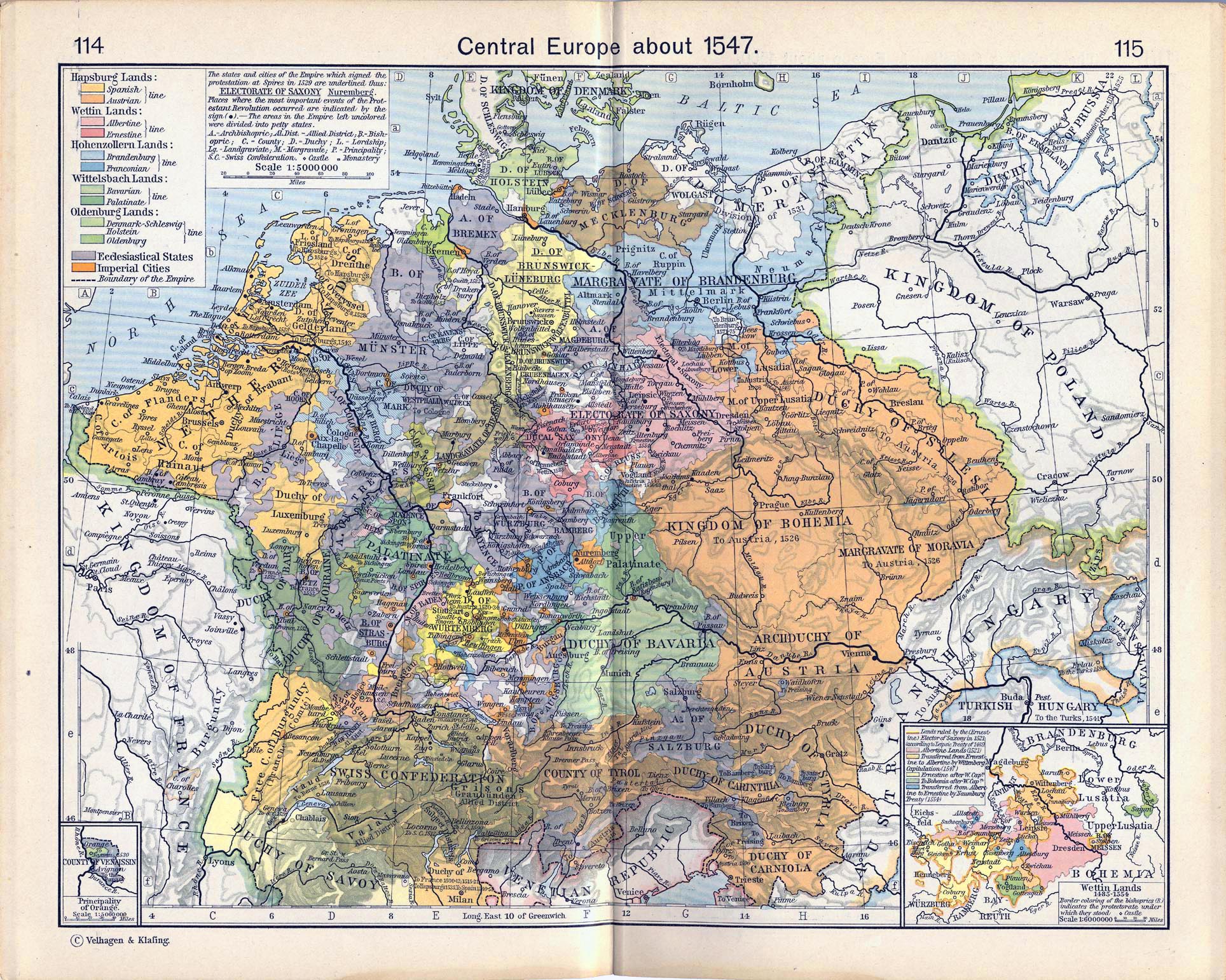
Historical Map of Central
Europe about 1547.
Illustrating
Hapsburg Lands
 About the Habsburg Dynasty
- Spanish line
- Austrian line
Wettin Lands
About the Wettin Dynasty
- Albertine line
- Ernestine line
Hohenzollern Lands
About the Hohenzollern Dynasty
- Brandenburg line
- Franconian line
Wittelsbach Lands
About the House of Wittelsbach
- Bavarian line
- Palatinate line
Oldenburg Lands
- Denmark-Schleswig-Holstein line
- Oldenburg
Ecclesiastical States
Imperial Cities
Boundary of the Empire
The states and cities of the Empire which signed the
protestation at Spires in 1529 are
underlined. Places where the most important events of the
Protestant Revolution occurred
are indicated by a dot. The areas in the Empire left uncolored
were divided into petty
states.
A - Archbishopric
Al. Dist. - Allied District
B - Bishopric
C - County
D - Duchy
L - Lordship
Lg. - Landgraviate
M - Margravate
P - Principality
S.C. - Swiss Confederation
- Castle
- Monastery
Inset: Wettin Lands
1485-1554
Illustrating
Border coloring of the bishoprics (B) indicates the protectorate
under which they stood.
- Castle
- Lands ruled by the (Ernestine) Elector of Saxony in 1521
according to Leipsic Treaty of 1489
- Albertine Lands (1521)
- Transferred from Ernestine to Albertine by Wittenberg
Capitulation (1547)
- Ernestine after Wittenberg Capitulation
- To Bohemia after Wittenberg Capitulation
- Transferred from Albertine to Ernestine by Naumburg Treaty
(1554)
Inset: Principality
of Orange
Illustrating
-
Rhone River
- County of Venaissin
- To Nassau, 1530
- Avignon, to the Papacy
- Durance River
Credits
University of Texas at Austin.
Historical Atlas by William Shepherd (1911).
Related Maps
Map of Central Europe in 1378
Map of Central Europe in 1477
Map of the Wettin Lands 1485
Map of the Swiss Confederation 1291
More History
 |
