|
Map Description
Historical Map of Ancient
Syracuse
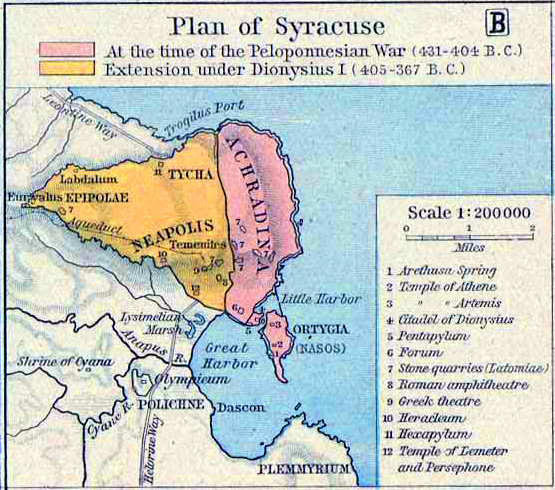
Plan of Syracuse:
Pink -
At the time of the Peloponnesian War (431-404 B.C.)
Orange -
Extension under Dionysius I (405-367 B.C.)
Illustrating
Arethusa Spring
Temple
of Athene
Temple of Artemis
Citadel of Dionysius
Pentapylum
Forum
Stone quarries (Latomiae)
Roman amphitheater
Greek theater
Heracleum
Hexapylum
Temple of Lemeter and Persephone
Credits
University of Texas at Austin.
Historical Atlas by William Shepherd (1923-26)
Related Links
 About the Peloponnesian War
About Dionysius I the Elder
About Siege of Syracuse
About the Peloponnesian War
About Dionysius I the Elder
About Siege of Syracuse
Related Maps
Map of Ancient Italy - South
Map of the Bay of Syracuse
More History
 |
