|
Map Description
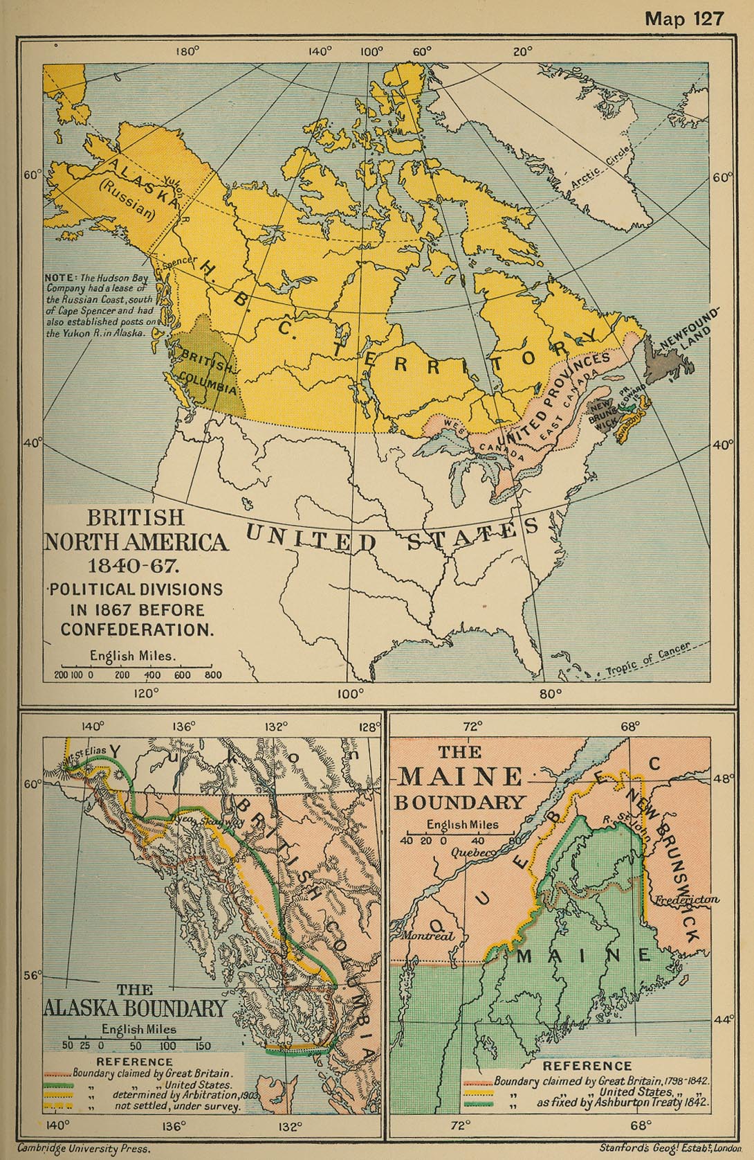
Historical Map of British North
America 1840 - 1867. Political Divisions in 1867 before
Confederation.
Note: The
 Hudson's
Bay Company had
a lease of the Russian Coast, south of Cape Spencer and had
Hudson's
Bay Company had
a lease of the Russian Coast, south of Cape Spencer and had
also established posts on the Yukon River in Alaska.
Inset: The Alaska Boundary
Boundary claimed by Great Britain
Boundary claimed by the Unites States
Boundary determined by Arbitration, 1903
Boundary not settled, under survey
Inset: The Maine Boundary
Boundary claimed by Great Britain, 1798-1842
Boundary claimed by the United States 1798-1842
Boundary as fixed by Ashburton Treaty
1842
Credits
University of Texas at Austin.
From the Cambridge Modern History Atlas, 1912.
Related Links
About the American Civil War
Related Maps
The States Access the Union - Map
More History
 |
