|
Map Description
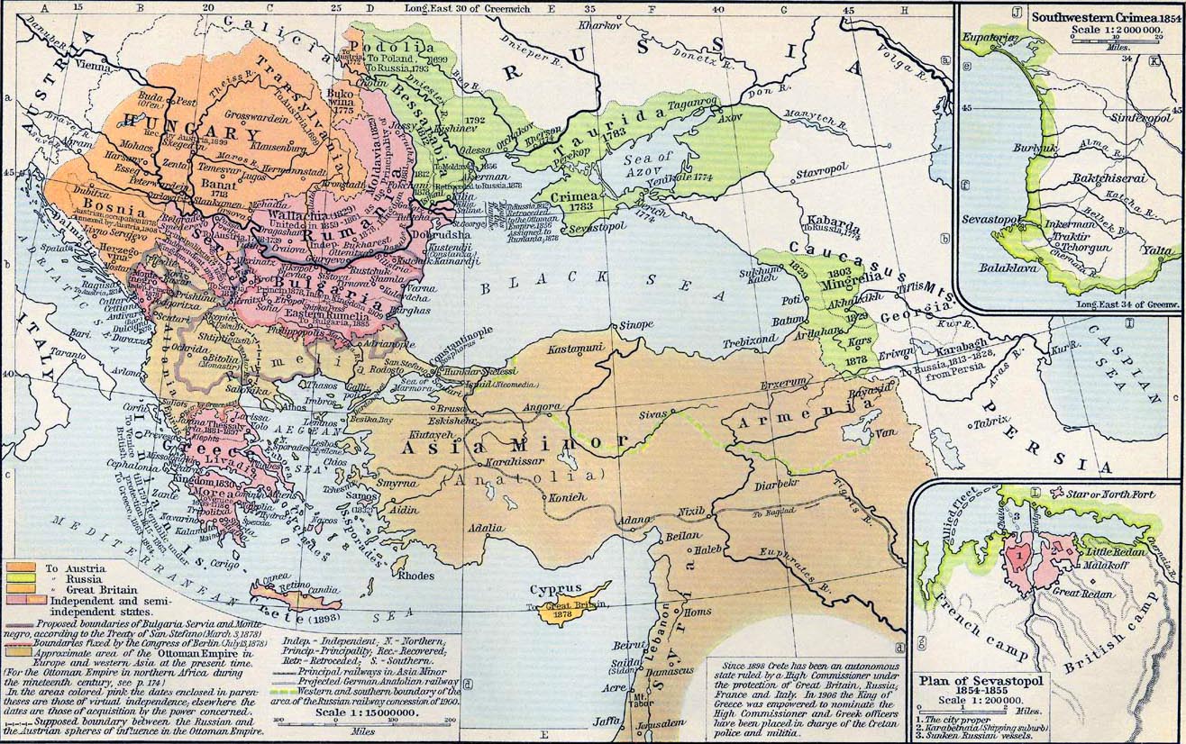
Historical Map of the
Dismemberment of the Ottoman Empire since 1683.
Illustrating
- To
Austria
- To Russia
- To Great Britain
- Independent and semi-independent states
- Proposed boundaries of Bulgaria, Servia and Montenegro,
according to the
Treaty of San Stefano (March 3, 1878)
- Boundaries fixed by the
 Congress of
Berlin (July 13, 1878)
- Approximate area of the Ottoman Empire in Europe and western
Asia at the present
time (1911).
For the Ottoman Empire in northern Africa during the nineteenth
century see
 Map of Africa in 1912.
In the
areas colored pink the dates enclosed in parentheses are those of
virtual independence,
elsewhere the dates are those of acquisitions by the power
concerned.
-
Supposed boundary between the Russian and the Austrian spheres
of influence in
the
 Ottoman
Empire
- Principal railways in Asia Minor
- Projected German Anatolian railway
- Western and southern boundary of the area of the Russian
railway concession of 1900.
Insets: Southwestern Crimea, 1854. Plan of Sevastopol, 1854-1855.
Credits
University of Texas at Austin.
Historical Atlas by William Shepherd (1911).
Related Links
 About the Russo-Turkish Wars
 About the Great Northern War
Related Maps
 Map of Constantinople
 Map of the Ottoman Conquest 1451-1566
 Map of the Ottoman Empire 1481-1683
 Map of the Ottoman Empire in Asia 1792
 Map of the Ottoman Empire in Europe 1792-1870
 Map of the Ottoman
Empire in Europe 1870-1878
 Map of
The Black Sea: The Crimean War 1853-1856
 Map of Europe 1871-1914

More History
 |