|
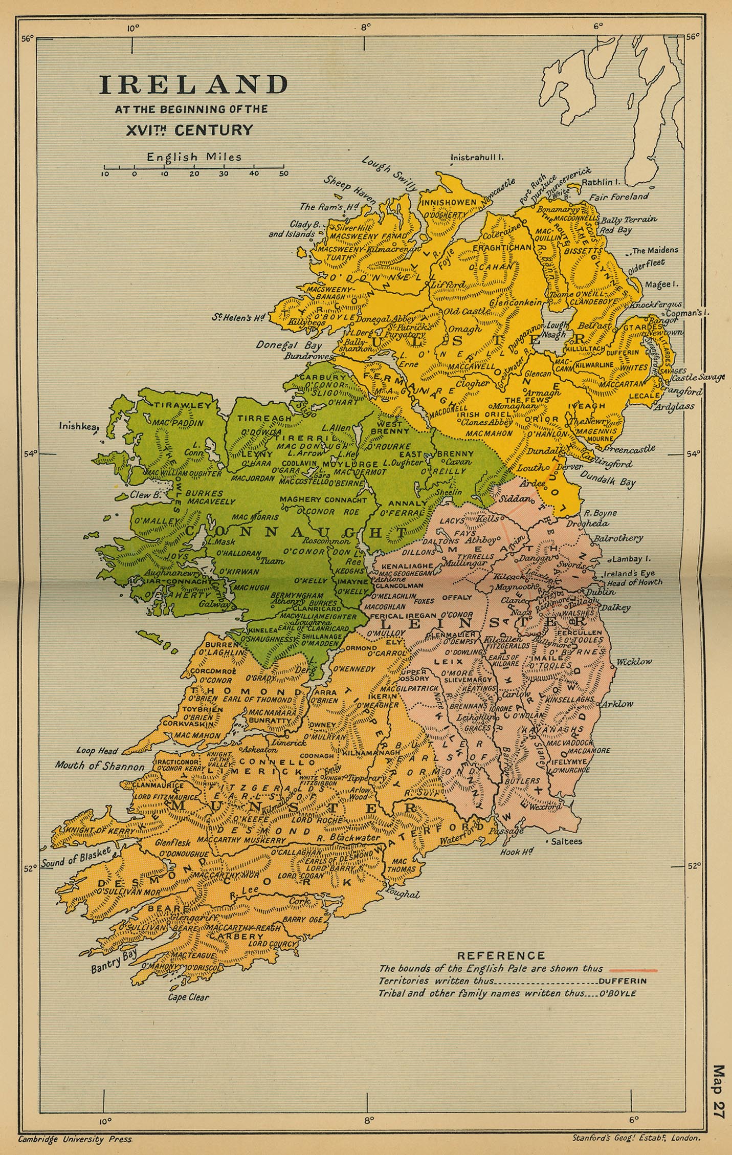
Map Description
Historical Map of Ireland at
the beginning of the Sixteenth Century
Illustrating
- The
bounds of the English Pale
-
Territories
-
Tribal and other family names
Credits
University of Texas at Austin.
From the Cambridge Modern History Atlas, 1912.
Related Maps
 Map of Ireland 1558-1652
 Map of Ireland: The Act of Settlement 1653
 Map of Ireland 1660-1800

More History
 |