|
Map Description
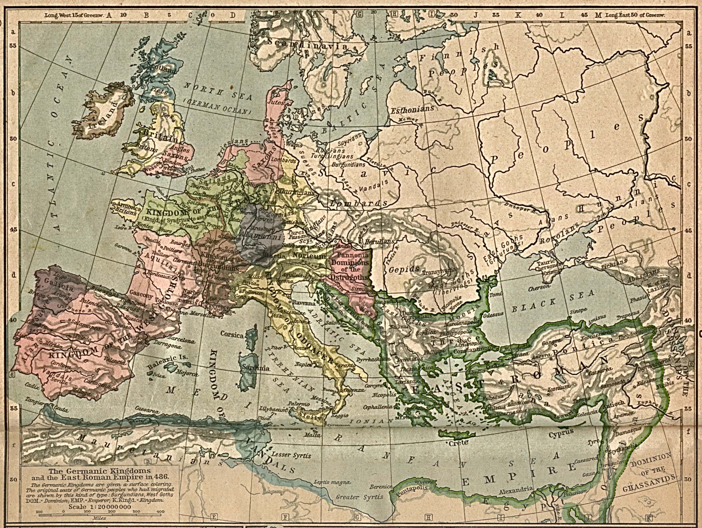
History map of the Germanic
Kingdoms and the East Roman Empire in 486
The Germanic Kingdoms are given a
surface coloring.
Illustrating:
- The original seats of Germanic peoples who had migrated
- Dominions
- Kings
- Emperors
- Kingdoms
Keywords
Picts, Britons,
 Angles,
 Saxons,
 Jutes,
 Lombards, Friesians, Alamanni,
Illyria, Salians, Armorica,
Kingdom of the
 Franks, Kingdom of Syagrius,
Dominion of the
 Ostrogoths, Kingdom of
Odoacer,
 East Roman Empire,
Kingdom of the
 West Goths,
 East Goths, Moesia, Thrace,
Kingdom of the
 Vandals,
Kingdom of Emperor Nepos, Aquitaine, Gepids, Galicia,
 Sueves,
 Alans, Kingdom of the
 Burgundians,
Dominion of the Ghassanids, Dominion of the Sassanids, Hunni
Peoples, Kingdom of the Lazians, Abasgians, Zichians,
Tauric Chersonese, Roxolans, Thervings, Greutungs, Herulians,
Pontica, Asiana, Noricum, Pannonia, Esthonians
Credits
University of Texas at Austin.
Historical Atlas by William Shepherd (1923-26)
Related Maps
 Map of Attila's Empire
 Map of the Germanic Migrations
 Map of the Germanic Kingdoms and the East
Roman Empire in 526
 Map of Europe and the
East Roman Empire 533-600
 Map of the Settlements
of Angles, Saxons and Jutes in Britain about 600

More History
 |