|
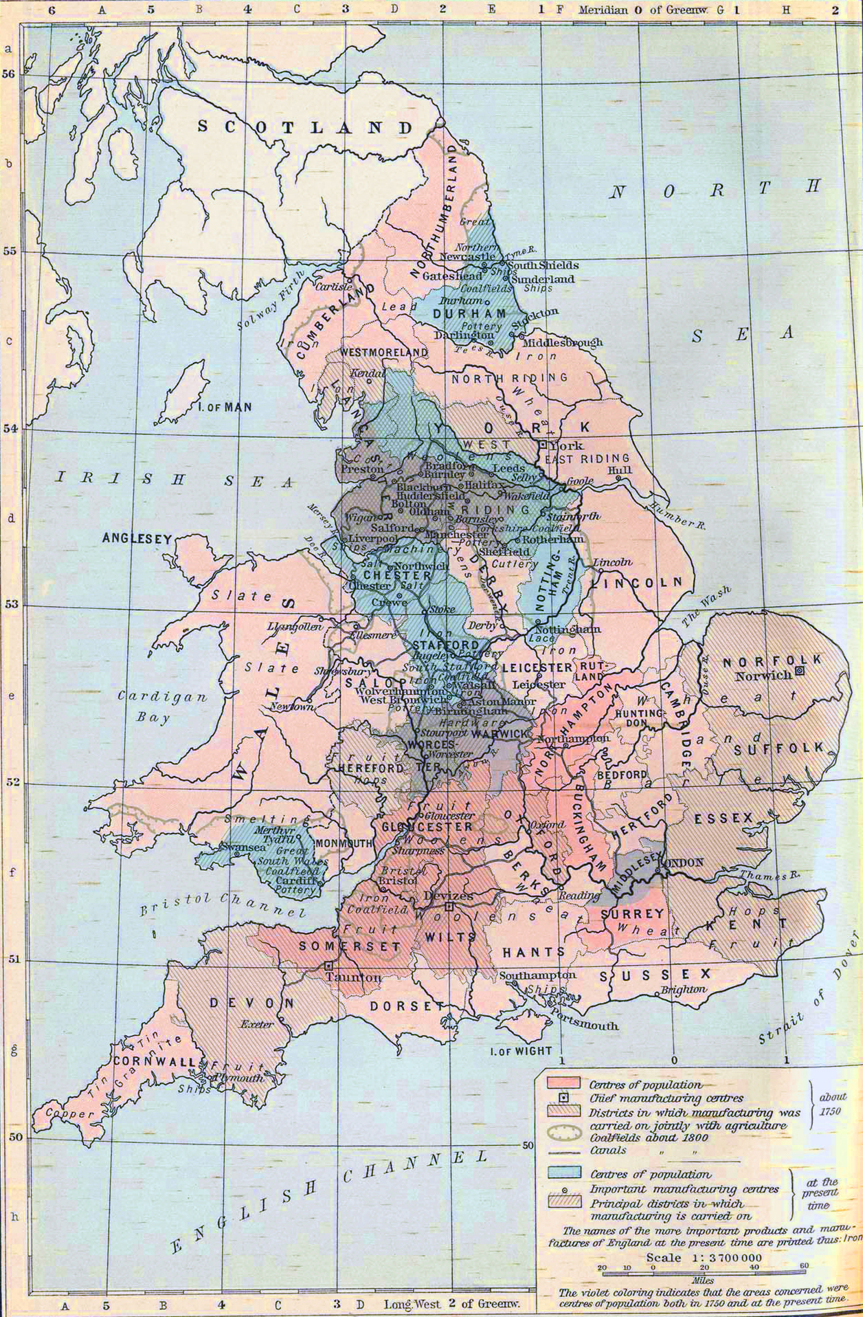
Map Description
Historical Map of Industrial
England since 1750.
Illustrating
-
Centers of population about 1750
-
Chief manufacturing centers about 1750
-
Districts in which manufacturing was carried on jointly with
agriculture about 1750
-
Coalfields about 1800
-
Canals about 1800
-
Centers of population about 1910
-
Important manufacturing centers about 1910
-
Principal districts in which manufacturing was carried on about
1910
The violet coloring indicates that the areas concerned were
centers of population both
in 1750 and 1910.
Credits
University of Texas at Austin.
Historical Atlas by William Shepherd (1911).
More History
 |
