|
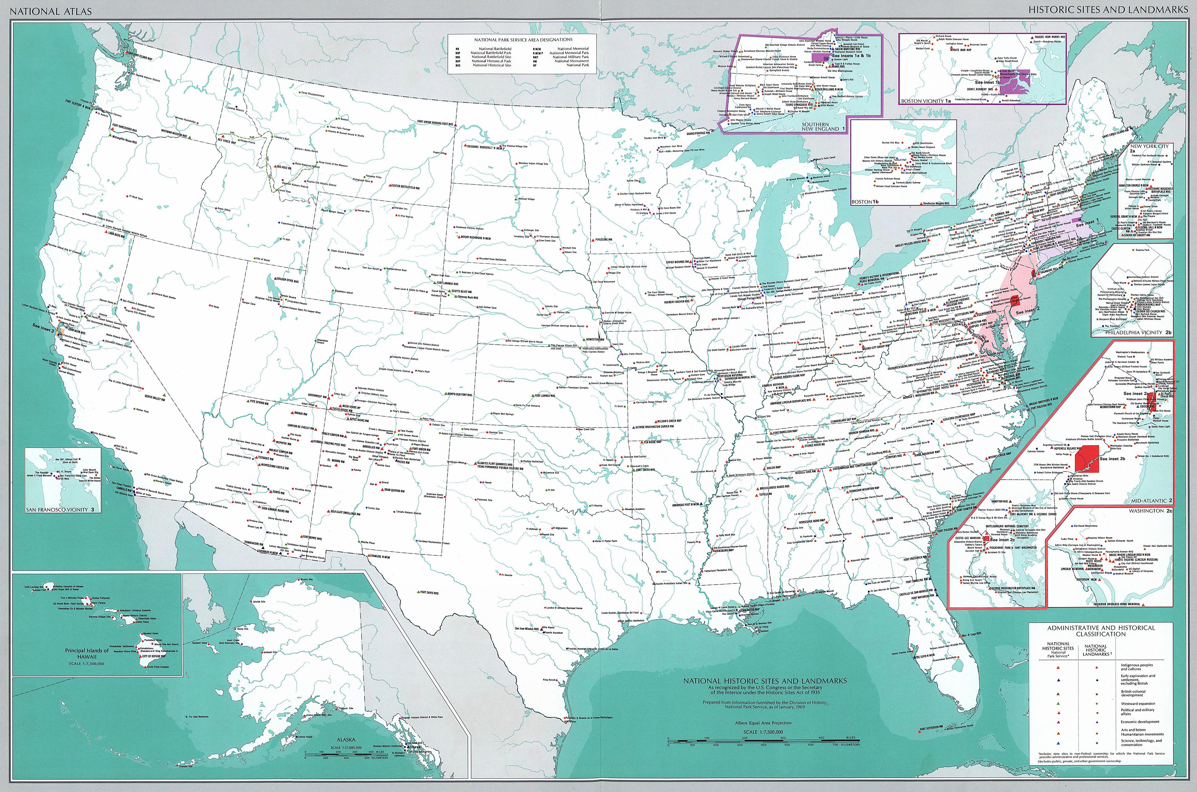
Map Description
History Map of the United
States - National Historic Sites and Landmarks as recognized by the
U.S.
Congress or the Secretary of the Interior under the Historic Sites
Act of 1935.
Inset
maps: Southern New England, Boston vicinity, Boston, New York
City, Philadelphia vicinity,
Mid-Atlantic, and Washington
Credits
The University of
Texas at Austin. From the National Atlas of the United States of
America (1970).
Related Links
 About Trinity Site, New Mexico
Related Maps
Map of New Mexico - Historic Sites
More History
 |
