|
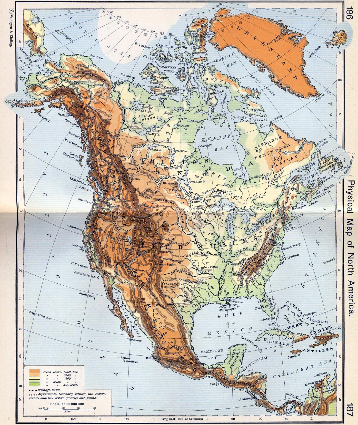
Map Description
Physical Map of North America
Illustrating
-
Areas above 5,000, 1,600, and 600 feet
- Areas below 600 feet
- Areas below sea-level
Drainage divide
Approximate boundary between the eastern forests and the western
prairies and plains.
Credits
University of Texas at Austin.
Historical Atlas by William Shepherd (1911).
Related Maps
 Physical Map of the British Isles
Physical Map of Europe, Asia, and Africa
Physical Map of the British Isles
Physical Map of Europe, Asia, and Africa
Physiographical Map of North America
Map of the Shifting of the Continents
More History
 |
